Rooted in Saxon origins and shaped by trade, faith, and education, Dedham’s rich history continues to define its character and charm.
From a Saxon manor mentioned in the Domesday Book to the village known as ‘Constable Country’, Dedham’s story is one of trade, religion, education, and timeless beauty. Its evolving landscape and rich cultural past continue to shape the village we know today.
Although there is some evidence of Bronze Age, Iron Age and Roman presence in the vicinity, the first known settlement at Dedham is the Saxon manor recorded in the Doomsday Book. From Norman times, this was held by absentee French landlords until, in the fourteenth century, it reverted to the Crown. By the end of the fifteenth century, when wealthy clothiers financed the building of the present church, Dedham had become a thriving industrial town.
During the seventeenth century the wool trade was in serious decline but the town’s importance as a centre for local trade was increased by its ecclesiastical significance. A lectureship had been set up around 1577 to preach the ‘pure’ word of God in this Puritan area, and the lecture coinciding with the weekly market drew audiences from miles around. The Grammar School, where the celebrated painter John Constable was later a pupil, was founded at about the same time.
This growing reputation for education and community helped shape Dedham’s next chapter. This established Dedham’s educational standing, and for the next four centuries, its various schools made significant contributions to the town’s prosperity.
In the eighteenth century, both the Grammar and English (elementary) Schools were rebuilt in the then fashionable red brick. Many of the late medieval timber-framed houses were refronted, and the community acquired its own Assembly Rooms.
However, by the closing years of the nineteenth century, the market town had dwindled to a village and was once again in decline – until the arrival of the first visitors and day trippers, drawn to the landscape that had become famous as ‘Constable’s Country’.
Its special qualities were officially recognised in 1969 when Dedham was designated an Area of Outstanding Natural Beauty. Tourism continued to grow throughout the twentieth century, especially with the rise of car ownership from the 1950s onwards.
This section is devoted to maps of Dedham including Ordance Survey maps recently scanned by the National Library of Scotland.
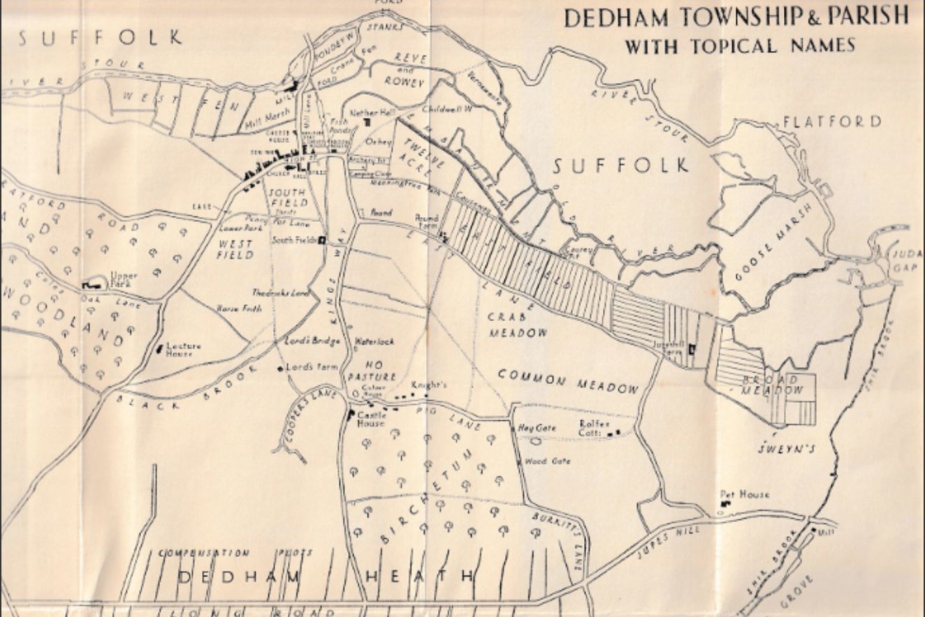
The map shows the compensation plots and the Dedham enslosures on Long Road West. This map was included in the book by Gerald Rendall, Dedham in History – Feudal, Industrial, Ecclesiastical, published in 1937.
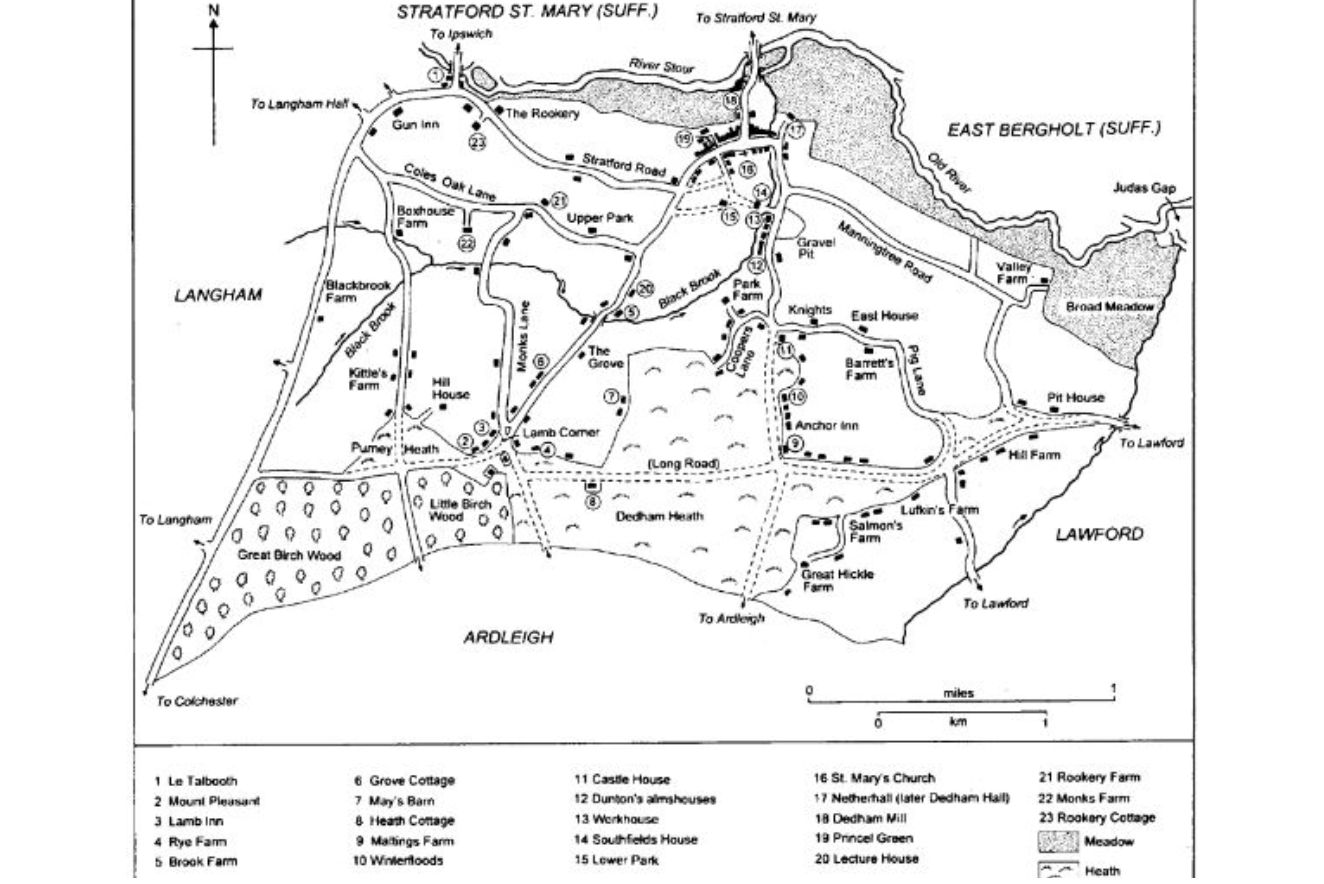
This map offers a historical view of Dedham circa 1790, featuring key landmarks, connecting roads, and nearby villages. It provides insight into the parish layout and local geography during the late 18th century.
In the NLS ‘Map images’ resource you can access and view all the maps that NLS have scanned as high-resolution, colour, zoomable images. The maps date between 1560 and 1964 and relate primarily to Scotland but also have maps of areas beyond Scotland, including maps of England and Great Britain, Ireland, Belgium, and Jamaica.